Delhi-Dehradun elevated highway is under construction over a well known active Mohand Rao…
what is our role in it..? Just to accelerate this natural phenomenon..? Or trying to create obstruction in its path...?

MPS Bisht: Dear friends once again I got the aportunity to have traverse along Mohand Rao (Raja ji National Park). In my last visit along with my MSc students we tried to find out traces of Main Frontal Thrust (MFT) – a tectonic alignment separates Siwalik foothills in north from Indo Gangatic Plain to south with some fossil locations.
 Geologically, the Siwalik Hills belong to the Tertiary deposits of the Outer Himalaya. They are chiefly composed of sandstone and conglomerate rock formations, which are the solidified detritus of the Himalaya to their north; they are poorly consolidated as it can be seen in the picture. The remnant magnetisation of siltstones and sandstones indicates that they were deposited 16–5.2 million years ago.
They are bounded on the south by a fault system called the Main Frontal Thrust, with steeper slopes on that side and in the north by Main Boundary Fault (MBT). Below this, the coarse alluvial Bhabar zone makes the transition to the nearly level plains. Rainfall, especially during the summer monsoon, percolates into the Bhabar, then is forced to the surface by finer alluvial layers below it in a zone of springs and marshes along the northern edge of the Terai or plains.
Friends now a days the people of Uttarakhand are worried about heavy rainfall discharged along all the reverine vallies resulting heavy damage of man-made structures like buildings, roads, bridges, along with breach out of huge agricultural chunks. What to do..? It is called “Natural Calamities”. But sad part is- what is our role in it..?. Just to accelerate this natural phenomenon..? Or trying to create obstruction in its path…?
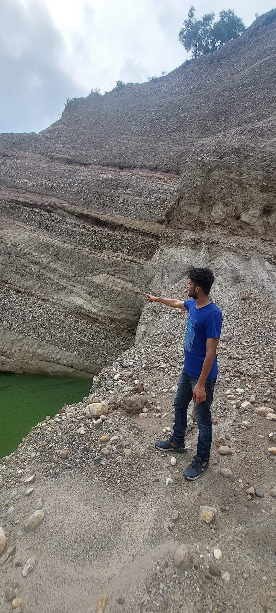 Look in to the pictures – a very prestigious Delhi – Dehradun elevated highway is under construction over a well known active Mohand Rao intermetent/torntial channel passes across the Siwalik hills with huge discharge and sediment load in monsoon season. Resulting all the pillars of elevated roads either submerged ithese sediments or eroded at their base. We the geological faternity do our best practices and try to axplain each and every important points of the terrain to the students, engineers, policy planners, discigen makers of our countary, but who cares…? They have their own priorities…? But friends still everyone is worried, whether the fate of this flyover will be the same as seen every where in uttarakhad..?
Note: The author is professor in the Department of Geology at HNB Garhwal Central University